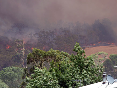
Lobethal, South Australia
Photos of Lobethal's Weather

Snow at Lobethal 18
th August 1996.
(Photo Peg & Bill Chartres' collection
Circa 1996)

Snow at Lobethal 18
th August 1996.
(Photo Peg & Bill Chartres' collection
Circa 1996)

Snow at Lobethal 18
th August 1996.
(Photo Peg & Bill Chartres' collection
Circa 1996)

Hail at Lobethal.
(Photo Peg & Bill Chartres' collection)

Lobethal, located in the Adelaide Hills, about 40 km from
Adelaide, SA, Australia, has a generally mild, warm and
temperate Mediterranean Climate with an average rainfall
of about 860mm.

During summer the temperature can reach the mid-forties,
but these hot days are usually followed by mild (and
sometimes cold) evenings.
Frosts occur, but are rarely
extremely severe and snow has been recorded on a few occasions.

The last heavy snowfall was 18th August 1996.


Flooding at Lobethal.
Photo Peg & Bill Chartres' collection.

Our grandchildren Greg & Scott enjoy(?) a frosty morning at Lobethal.
(Photo Peg & Bill Chartres' collection
Circa 2005)

Our grandchildren Greg & Scott enjoy(?) a frosty morning at Lobethal
(Photo Peg & Bill Chartres' collection
Circa 2005)

Our grandchildren Greg & Scott enjoy(?) a frosty morning at Lobethal
(Photo Peg & Bill Chartres' collection
Circa 2005)

Flooding at Lobethal.
(Photo Peg & Bill Chartres' collection
Circa)

Rainbow at Lobethal
(Photo Peg & Bill Chartres' collection)

Hail storm at Lobethal.
(Photo Peg & Bill Chartres' collection
Circa 2005)
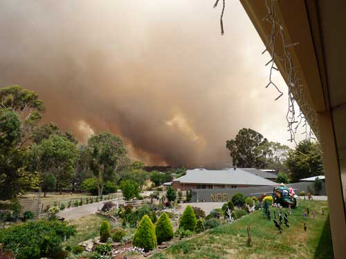
The Cudlee Creek fire was declared an emergency disaster as Country Fire Service crews continue
to battle flare-ups ahead of deteriorating weather conditions.
As at 23/12/2019 the number of houses destroyed by the fire was 87, along with almost 500 other
buildings and 278 vehicles and these number are likely to increase as the fire is still uncontained (24/12/2019).
Agricultural losses are also mounting with about 1100 hectares of vineyards thought destroyed or
damaged, equal to about one-third of the area’s grape production.
The industry’s potential damage bill is expected to be in excess of $100 million.
Starting in Cudlee Creek on Friday, the flames tore a path of destruction through Lenswood,
Lobethal, Charleston, Woodside, Harrogate and nearly everything in between before being halted near Mt
Torrens, more than 13km away.
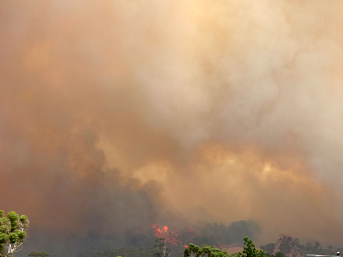
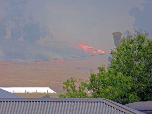
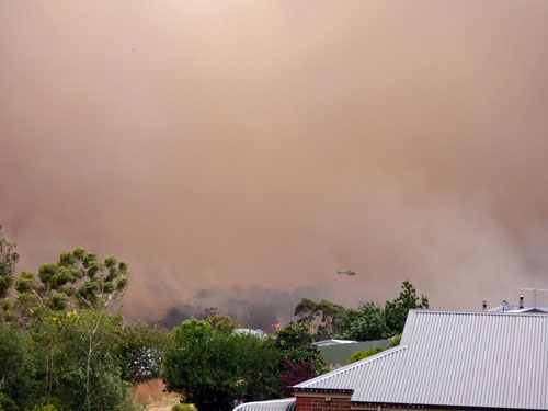
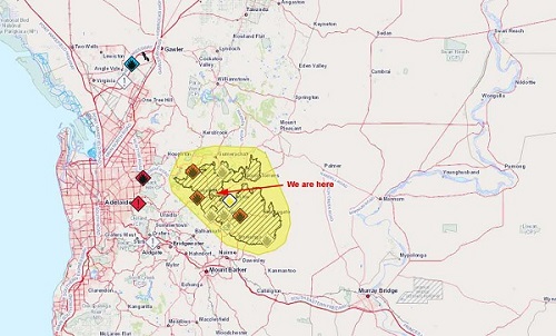
MAP OF THE BUSHFIRE AREA
(24/12/2019)
[Readings correct as at 5:03p 03/06/23]
|
Temperature |
15.9º C
|
Wind Chill |
15.9º C
|
Wind |
NE at 0.0km/hr |
Today's Rain (Daily Rainfall measured from
12:00am) |
0.0 mm |
Year's Rain (to date)
|
268.6 mm |
Barometer (Corrected sea-level barometric
pressure ) |
765.5 mm (&
Rising Slowly) |
Humidity |
78% |
Dewpoint |
12.1º C |
Current Moon Phase
Full Moon
Crescent refers to the phases where the moon is less than half
illuminated.
Gibbous refers to phases where the moon is more than half illuminated.
Waxing means "growing" or expanding in illumination, and
Waning means "shrinking" or decreasing in illumination.
|
WEATHER OUTLOOK
Increasing clouds with little temperature change. Precipitation possible within 24 to 48 hours .
|
Highs and Lows
High Temperature Low Temperature Low Wind Chill |
21.6ºC at 1:04p
10.2ºC at 7:32a
10.0ºC |
High Wind Speed |
8.0km/hr NE at 12:04a |
High Humidity Low Humidity |
89 % at 7:33a
49% at 12:48p |
High Dewpoint Low Dewpoint |
13.9ºC at 2:06p
8.3ºC at 7:24a |
Sunrise 6:59a
Sunset 4:56p
|